A Craigieburn Commute
Cass — Lagoon Saddle Loop, Craigieburn Forest Park
Coming out of the bush from tackling the Gladiator I had a problem. I needed to work out how best to spend the next few days whilst making my way to Christchurch to fly back to Wellington. Slowly but surely a plan started to form, starting with a memorable New Years in Fox, hitching up through Hokitika before coming through Arthur’s Pass. Looking on the topo the Cass — Lagoon Saddle Loop seemed like the perfect overnighter to get me to Christchurch on time and bag some huts along the way.
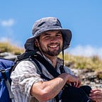
A public servant on his way to Timaru dropped me off by the turnoff to Cora Lynn Road just after midday. I hauled my pack up onto my back and started trudging towards Bealey Hut. This was not as easy as it sounds. That morning I had woken up with a killer pain up one side of my back, so bad that when I lay on the floor I couldn’t get myself up. My pack was also stuffed full of all the extra gear I had put into Mat’s car “just in case” for our trip up the Gladiator, meaning it was significantly heavier than it needed to be (I thought it unlikely that I would need crampons in the middle of summer up the Craigieburn, but you never know). So in quite of a lot of discomfort I trod, propelled by my own stubbornness. This discomfort was momentarily ignored when a little lamb started pestering me to take a photo, which I happily obliged to do.
Bealey Hut is only 5 minutes from the roadend, making it an excellent overnight stopover on a Friday night. Opening the door I was hit by a wall of heat and I decided that the pain in my back was preferable to cooking all day in the hut.
I plodded onward, asking myself what would I do with a drunken tramper early in the morning. The beech forest was alive with sights and smells, the trees flowering in a spectacular display of red.
The track climbed slowly but steadily and sweat began to pour out of me. After a zig-zag the beech gave way to pines, the forest floor feeling noticeably darker and less alive. These pines were planted in the 1980’s by the Forest Service as a erosion prevention trial. The upside of the dark forest floor was that I got a momentary relief from the heat before one last section of beech and then the open tussock tops. The track was boggy in places and interspersed by pleasant glades of beech, through which ran refreshing mountain streams.
The view from the steadily climbing track was magnificent, stretching out over the Waimakariri and the peaks of Arthur’s Pass. After 2 kilometres the track swings to the south above Lagoon Saddle, nestled between Mt Bruce and Mid Hill. Another kilometre brought me to Lagoon Saddle A-Frame, which was built in 1983 in a sunny clearing above the infant Harper River. The A-Frame is actually a shelter , although that isn’t marked on maps or on DOC’s website. The need for the shelter isn’t apparent in summer, but in winter heavy snows can fall in the area like those that trapped a Christchurch couple for three days.
I put my pack down at the front door, wincing as my back groaned. Snack in hand I followed the path behing the hut and across the stream to investigate the older Lagoon Saddle Hut. Built by the Forest Service, Lagoon Saddle Hut is basically a shiny silver shed with bunks, but looked dry and cosy enough inside.
Back at the A-Frame I put my pack back on and made my way down the valley. The track followed the river, occasionally dipping down to it on broken rock before climbing away again. The forest was lush, providing welcome shade from the harsh midday sun.
Open sections along the river were marked by cairns, orange triangles indicating where the track went back into the bush. Suitable camping spots abounded along the river’s bank, probably well used as the Te Araroa runs through the area.
It was just after 4pm when I arrived at West Harper Hut. The hut was built in 1957 to accommodate cullers and is older than most of the others on the track. The structural timbers obviously came from the surrounding bush and canvas bunks. Nevertheless it seemed like a nice spot, or did until the sandflies came out.
Continuing on down the track it wasn’t long until I reached the swingbridge over the Harper River. I passed the turnoff to Mirror Tarn (a 20 minute detour) and crossed a second smaller swingbridge over Hamilton Creek. From here is was just a short jaunt around the corner to the Hamilton Hilton, aka Hamilton Hut, which I reached just after 5pm.
Situated on a terrace above the wide creekbed, the spacious 20 bunk serviced hut is positively palatial. The hut was built by the Forest Service during the hut building boom of the 1970’s, just downstream of where an earlier tent-camp existed. Central to the hut is a impressive stone fireplace which dominates the living area. In one corner sits a mountain radio, enabling communication with the outside world. A quaint notice on the wall informs users that the Forest Service no longer provides rubbish pits (i.e. miniture landfills) for hut users.
As I discovered the hut is popular with Te Araroa walkers, with three being in residence when I was there, along with a pair of trampers from Canterbury. After some quick yarns I ducked off to the creek for a bit of a dunk. Dinner that night was an amalgamation of leftovers, consisting of instant mash, deconstituted cheeses, chipotle spice mix and wraps. I think it came full circle from looking revolting to actually being kind of appealing, if the words of the TA walkers were to be believed. Bit too much salt for my taste.
Later in the evening as I was playing cards with some of the others there was a great commotion. In the distance two naked older women could just be made out splashing around in a creek, in full view of the hut. A third (dressed) individual appeared, and it turned out that these were British tourists who had had a bit of a rough day acclimatising to the relative wilderness compared to the European alps (it had taken them 10 hours to walk a DOC 6 hour track…).
The following morning the TA walkers were up early, motivated by the thought of a big feed in Methven. I was in much less of a rush, waiting for everyone else to leave before I gave the hut a good clean down. It was around 9am by the time I set off. Thankfully I had something to take my mind off my back, as my heals were on absolute fire. Breaking in new boots over the last few weeks had really done a number on them and it was positively painful to walk. After a kilometre I couldn’t take it any more, switching into my old sneakers which did the trick. The track from the hut follows the river before climbing into bush that has been overtaken by loose rock from above. The result of this was track markers attached to trees at about waist level.
Once in the forest it was a pleasant meander for several kilometres before the stream draining Hamilton Peak was reached. From here the track took a more vertical approach, making me curse every superfluous kilogram I was carrying. 300 vertical metres later and I was sweating in the sunshine as I crossed Cass saddle.
The saddle itself was a bit slippery and one had to watch out for the resident spaniards. The Craigieburn Range soared above me, hiding the club skifields on the other side. I continued on, soon dropping to the bushline. The bush here must have been hammered by a storm at some point in the past as trees were lying around like pick up sticks. Luckily a path through had been cleared, leading me directly to Cass Saddle Hut which had miraculously avoided getting squashed.
Cass Saddle Hut was built in 1953 and is probably my favourite out of all the huts on the track. Well looked after, the hut has a unique split door leading into a living space with a bunkroom behind. It would definitely make a cosy destination in the snowy months of the year. Just down from the hut a spring fed stream babbles past, making for a refreshing drink. The going from the hut was good, passing through yet more beech, crossing a bridge over the Cass River before beginning a high sidle.
Eventually I rejoined the river and was forced to bite the bullet and get my sneakers wet. The final section of the track followed the river as the valley widened up. I passed by Romulus and was greeted by an aunty/niece duo heading in the other direction who gave me some great tips for a trip down at Lake Ohau.
I crossed the river one last time before joining on a 4WD track that seemed to stretch on forever. Soon the familiar hum of traffic was audible and I jump the fence into the carpark. It was around 1:30pm. From there I managed to hitch to Darfield with some ex-Southland farmers, before getting picked up by a big lefthand drive 4WD and we hooned into Christchurch, muffler blaring, windows down.
I’m not sure its a commute that I would like to make regularly, but the Cass-Lagoon track certainly makes for a pleasant two day trip with plenty of interesting huts along the way. I would say the track is suitable for people who are looking for something a bit more adventurous. It’s no Great Walk, but it is a relatively straightforward walk (in fine weather) through some awesome backcountry.