Crown of the Tararua Range
Dorset Ridge Hut, Tararua Forest Park
“Although the monarch of the Tararuas, The Mitre, is very little higher than a number of other peaks in the range, in normal conditions it is a very easy climb. The loading spur, falling away steeply to Mitre Creek, on its southern flank, is very direct and free from-dips; it leads first to Peggy’s Peak, the lower peak, from which the highest point is but a very short distance”.
— Evening Post, 14 November 1930.
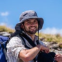
My tally of Tararua huts had come down to single digits, yet with adventures beckoning from further afield I was making little progress in my goal of visiting every hut in the forest park. Dorset Ridge Hut was one of these stubborn hold outs. Located in the north of the park in the shadow of Pukeamoamo / Mitre, it promised alpine views and an interesting route. I somehow managed to convince Tess that this was the ‘chill’ tramp perfect for the upcoming weekend.
Our plan was simple. We would walk from the Pines up the Barra Track on Friday, passing Mitre Flats Hut on our way over Mitre. Once the peak had been conquered we would traverse the range, dropping down Dorset Ridge to the hut itself. On Saturday the plan was to drop down the old cullers track to Dorset Creek which we would follow towards Park Forks before ducking up a spur to McGregor Biv. It would then be a simple matter of traversing the Broken Axe Pinnacles and the Three Kings, dropping down a spur and finding our way back to Mitre Flat Hut for the night. Sunday would then be a walk in the park out on the Barra Track. Sweet as.

1. Hot and bothered
Pines carpark to Mitre Flats Hut via the Barra Track
We left perhaps a little later than we should of to get over the hill to the Wairarapa. It was 11am by the time we set foot on the road leading up to the Barra Track. Passing a horde of school children heading in the other direction, we marched in silence towards the mountains. The sun was shining and by the time we hit the forest mugginess filled the air. I didn’t tell Tess that this was one of my least favourite tracks in the Tararuas. There isn’t anything particularly wrong about the Barra Track (named in honour of legendary culler Bert Barra), just that on a hot day the million-and-one bloody undulations really get to you.

Dripping with sweat I was counting down the creeks we had left to cross before the hut. After what felt like an eternity we reached a lonely looking DOC sign marking the steep descent to the bridge over the Waingāwa River. The river looked tantalisingly fresh, its sparkling waters calling us in. It was a short stomp from the bridge to Mitre Flats Hut, a perfect resting place in those isolated parts of the Tararua Range.

Unfortunately for any of my ambitions it was too perfect a resting place. Tess had just come off ten days of shift work and so there was no convincing her to move on after we had stopped. The upshot of this was it meant that after lunch we had all afternoon to enjoy a swim in the river and read our books. As evening set in we were joined by a woman and her very talkative dog Oscar, who set up their tent at the far side of the hut clearing. Lying in my sleeping bag that night I mulled the question of “what now” given our relaxed day. A problem to solve tomorrow I thought as I drifted off to sleep.
Following the infamous Sutch search of 1933 where Mitre Flats served as a canvas field base for the volunteer searchers, local tramping clubs decided that a hut was needed. The Mt Holdsworth and Wairarapa tramping clubs built the first Mitre Flats Hut in 1933–34, with much of the material being brought in by horse over Mt Blake. By the 1950s the clubs that built the first hut had disbanded and the hut was deteriorating quickly. Masterton YMCA Tramping Club took on the challenge of looking after the hut and replacing it. Over 1951–52 over three tonnes of material was walked into the flats by trampers. Despite disaster where a slip blocked the river, washing away many of the building materials, the second Mitre Flats Hut being officially opened in 1953 following a successful salvage effort. Masterton Tramping Club was formed by a merger of the YMCA club with another outdoors club in 1957, with the new club taking on the hut. In 1975 discussions started on a replacement for the second hut - this finally came to fruition in 1988 with the opening of the present hut.

2. Good bishop, bad bishop
Mitre Flats Hut to Dorset Ridge Hut via Mitre
Saturday morning dawned bright and beautiful. We decided to try get going earlier to give us plenty of time, whatever the day might throw at us. There was no easing into it, the ascent from the flats was steep and unrelenting. This abrupt climb eventually relented, looking up from my boots I caught a glimpse of nature in one of her most picturesque and fantastic moods. The bush was a live with every shade of green imaginable. The fresh shoots of spring abounded. The feathered pillars of the punga rose up around us suspending their umbrella-shaped canopies.

The spur made for a mostly gentle climb, as if we were ascending up a great green wedding cake. Soon the beech became stunted, giving serious bushline vibes. By some miracle no sour squirms had been harmed by the time we were emerging above the forest.

It was a marvelous thing to be on the tops. Views stretched out over the Wairarapa as we plodded upward. Legs were tired but morale was high. Still, some sour squirms were required for extra support. Stony slopes gave way to tussock, wildflowers blossoming abundantly around us — Edelweiss and mountain buttercups, eyebrights and snow cushions — all thriving in an otherwise harsh alpine world.


Slowly but surely the mighty ramparts of Mitre grew closer. Wind buffeted us as worrying clouds flew overhead. Far in the distance we caught a glimpse of Dorset Ridge Hut’s red roof, an impossibly small speck in that epic landscape.

A few rocky scrambles were required to gain Peggys Peak. From there the monarch of ngā Tararua stood before us, its rocky summit barely below the clouds. Soon we were upon it. There was little incentive to prolong the stay on top, for the position was exposed to the full force of the gale. After a quick snack we turned to our next challenge, Brockett and Girdlestone.

The descent down the northwestern slopes of Mitre was far more precipitous than the way we had ventured up. Our feet slide down the loose rock, often skidding to a halt just above yet another little bluff that needed to be clambered down. This steep descent gave us access to the long saddle between the peaks which was easily crossed. As we began our ascent the clag began its assault in earnest. We ascended into this thick grey blanket to reach Brockett. A parting of the cloud revealed a momentary view of Tarn Ridge Hut, that tired young hut which waits for its replacement.

We turned left, striding staunchly against the gusts that assailed us from the north. It was well past a descent lunchtime so when I found a decent hollow we hunkered down for some kai. Exiting our hollow after lunch, we made the final climb to Girdlestone in next-to-no visibility. Here we made another direction change, turning to the northwest to descend down the narrow spur to Tarn and Dorset Ridges.

I was glad we had stopped for lunch as the day was stretching on and energy was precious. After several downs and ups we reached a cairn on a small knob, this was our turnoff to Dorset Ridge. With nothing but trust and a bit of GPS we headed west into gentler country.

We passed the substantial tarn marked on the map in a milky slurry of precipitation. Travel was easy but we had to take care to stay on the main ridge. Following pt 1351 we tended a bit more to the south, soon stumbling across two cairns. In our weary logic we reasoned that this must mark the descent. Following a rough path we lost a bit of altitude. Unfortunately, our rough path soon became swamped with vegetation, leaving us to wonder where to next in that sea of tussock. With foolhardy optimism we pushed on, soon stumbling upon more cairns. Unhelpfully, these did not really convey any general direction of travel. With little to go on we embraced our descent, roughly travelling down the middle of the broad spur in the direction of the hut. Tūpare (leatherwood) and Taramea (spaniard) resisted our progress. There had to be a track here somewh… Aha! An opening appeared in the scrub, the form of the hut materialising out of the clag.

It was a welcome sight, our shelter from the elements for the night. There was no thought of going on to McGregor. Bags were unpacked, gear exploding across the small interior of the hut. Soon both of us were in our sleeping bags, ready to read the afternoon away. Subtle snores rosed me from my National Geographic. A look outside revealed the cloud had begun lifting. I donned my crocs and set off up the track with camera in hand, careful not to wake Tess as I left the hut. The cloud lifted higher and higher as I climbed, spurring me to continue along what was a very well-cut track. I climbed and climbed until I could climb no further. On the ridgeline I discovered a familiar cairn, its usefulness a lot more apparent with greater visibility. To avoid future mishaps I set to work, knocking over and rebuilding cairns, hauling great stones here and there till even a blind man could follow my path.

Satisfied with my work and worried that Tess might have woken and be wondering where I was, I set off back towards the hut. This was a quick task, given I now knew where I was going. With the newfound visibility I could see the hut nestled at the treeline, surrounded by a mountain amphitheater consisting of the Three Kings, the Broken-Axe Pinnacles and McGregor.

When I neared the hut Tess came stumbling out, a troglodyte embracing the outside world. She had only just woken, so my whereabouts had not even crossed her mind. I excitedly told her of my rock work (maybe I am the troglodyte?) and of the views. With the sun now shining a chair was pulled out of the hut, a perfect perch to read one’s book.

Birds flew happily flew overhead, the bush reawakened with the setting sun. It was nirvana. When the sun sank beneath the horizon we ventured back inside for dinner. This was happily consumed followed by a packet of crackers we found in the hut, our own snack supplies running worryingly low. Sleep was then upon us.
Dorset Ridge Hut was built in 1968 to a standard S70 design by the Forest Service, to support deer culling operations. It replaced an earlier Department of Internal Affairs hut on Dorset Ridge that was built in 1955. The hut was looked after by the Horowhenua Hunters Club between 2005–2023, with a large front room being added during that period. The Greater Wellington Backcountry Network (GWBN) completed some maintenance and repainted the hut in 2023. It will be reclad soon.

3. Put in check
Dorset Ridge Hut to the Pines via the Three Kings
It was an early rise for us, with question marks hanging over the forecast for later in the day. As it was there was little visibility from where Dorset Ridge Hut was perched on the hill. Behind the hut a large orange triangle marked the beginning of the old cullers track to Dorset Creek. The hutbook told us that this had recently received some TLC from ex-culler Derrick Field. Legend. The route began with a steep drop down through goblin forest, followed by the occasional shelf. Thanks to Derricks efforts the track was well-marked and pretty easy to follow.


As we approached the creek the terrain steepened again, requiring great care and a bit of root clambering. The markers spat us out on the bank of the serenely flowing creek, just under an hour from when we had set out from the hut. I couldn’t help but smile.

Across the creek we could see an orange triangle. Reasoning that this marked the ascent, we crossed the creek. Slowly but surely we followed the markers upstream. Here I attempted to break my leg by inserting it between two fallen trees. I failed and instead we found the point where the permolat pointed straight up the hill. Cue some hard work…

The plus side of the steep climb was we made altitude fast. The bush on this side was less dense but the markers were mostly on the far side of the trees (marked for descending travelers), making for some touch and go nav.

Nearing the bushline the beech once again became stunted and the forest floor grew thick with cutty grass. After an hour and a half of climbing we emerged onto the tops. Any hope of views were quickly dashed by an all-too-familiar blanket of clag. We stopped so Tess could put on some more layers whereas I stubbornly opted to continue in just a shirt.

As we trundled up the undulating ridge an artic breeze was building. After 100m of climbing Tess sensibly asked me if I was warm enough without another layer on. I stopped, contemplated, shivered and dutifully donned my raincoat. In under five minutes I was left no doubt that Tess was right (as she usually is). By the time we reached the main ridge to South King the wind was howling a gale.

At times the strength of the wind was very disturbing to the equilibrium. A look over my shoulder confirmed that Tess was in danger of flying away. We skirted the southern slopes of South King, sheltering us from the wind but putting us (and Tess’s ungaitered legs) head-to-head with more taramea. Dropping off South King the wind continued to rise. I paused in a lee, soon joined by Tess. Her hands were iceblocks, her body shaking in the cold. There were some words of encouragement, some gingernuts and some more layers. We opted to soldier on in order to get off the tops as soon as possible. With determination we reached the old wooden sign on Middle King that marked the spur to Mid King Bivvy. We wasted no time in descending, scrambling down the steep country to get out of the wind. At times the route was unclear, but by sticking to the spur we made our way into the tūpare maze. What followed was a prickly, scratchy, spikey plod down through the sub-alpine scrub. It was a relief when the bushline finally came into sight.

We passed the turnoff to Mid King Bivvy, continuing on into the forest. The forest floor was open and the route was clear, although there were no markers to be seen.

We made good progress in our 1100m descent, or we were until we got to the 550m contour. Here the pronounced spur we had been following widened and we lost the worn footpad. I consulted the route I had marked on my phone, it turned off the spur and beelined down to South Mitre Stream. In doing so we lost any sense of a track, wandering through a dense web of fern and supplejack. I wondered if Tess would ever talk to me again after this. I was relieved when I caught sight of an orange ribbon fluttering in the breeze next to the stream.

We followed these as best we could, including across the stream and back again. Tess took the opportunity to soak her legs which were red-raw from the abuse they had received from the scrub. After the confluence with Baldy Creek we stuck to the true-right. There was one last ugly climb to join the Barton Track, very nearly the last time Tess ever talked to me. Luckily the climb relented, a benched track presenting itself to us. A short stroll down the track took us to the swingbridge to Mitre Flats.

“I’ll forgive you eventually”.
It was a short stroll up the track to the welcome sight of Mitre Flats Hut and the less welcome sight of someone in their grundies fresh from a swim. We made sure to make plenty of noise as we approached, finding the rest of the group of women who had just arrived from Cow Creek. I promised Tess a relaxed lunch and a cup of tea, and that’s what was delivered (with the very last of our gas).
An hour later we said our goodbyes to the women before heading off in the direction of the Barra Track. Over the Waingāwa we climbed. This was the first of many undules (you know, those units that make up undulations). We debated the definition of an undule as we walked, which helped pass the time. Tess was also rationing the last four squirms to ensure we had the energy to make it to the finish.

As we walked the sun began to shine, contrary to any forecast. In the muggy heat we began descending towards the farmland at the Pines. In a moment of brilliance I proposed a swim in the Waingāwa before the final sprint across the farm to the car. Turning right as soon as we hit the first paddock we found a deep swimming hole, glistening a beautiful green in the afternoon sun. Just what the doctor ordered.

We dove gleefully into the Waingāwa, relishing the feeling of the cool cleansing water on our skin. Drying off we set off across the farm. Other than a few cows the rest of the walk was uneventful, Tess’s car being right where we left it. What a day.
So we didn’t quite make it to McGregor Biv. We might have been blown about on the tops. We might even have run out of snacks. But despite all of those trials, Dorset Ridge Hut is a place I won’t be forgetting in a hurry. Conquering the monarch of the Tararuas was an added treat. I’ll be back for McGregor, with a few more snacks. And yes, Tess has started talking to me again!